
Lesser used paths are often very difficult to follow, and a wrong turn can lead you quickly into difficulties, or even plunge off a 100+ metre drop, especially on Table Mountain. So do some extra research and planning before setting out for the first time on a new trail.
Always research a route also on something like Google Maps that will show the contours, distances, places close by, and often photos and reviews. You can also try the 3D view, or else revert to Google Earth for that.
I’d also highly recommend a well-used app like AllTrails that shows not only recent reviews, but also gives an idea of how often a trail is in use. It also has a good side-view of the elevation along the trail. If you are not familiar with the area, try stick to busier routes like the Newlands Forest Trails or Kirstenbosch Gardens if you are on your own. AllTrails as well as Strava (both maybe premium I think) as well as Google Maps will allow you to share your location as you are moving. Privacy is absolutely not a consideration when out hiking or being on a trail run.
Safety against nature is only one consideration, and the other is unfortunately against humans. We’ve had a few instances of muggings, and even murder, in Cape Town so it is not recommended at all that especially non-residents go out alone on lesser used trails, or over the top of Table Mountain where there is little cellphone reception. Always try and hike or run with someone else, try stay within cellphone reception areas, and let others know where you are going, and when you expect to return.
Apps such as Casi cost only about $2 pm and can summon armed response to assist you. You can also consider installing an app (or automation app like Tasker or MacroDroid) that alerts you if cellphone reception has been lost.
If you’re a ham radio operator, carry your VHF/UHF radio with you as you can summon help on 145.700 or 145.750 FM from most areas where there is no cellphone reception, and rescue organisations such as WSAR often have a ham radio operator on board. If your radio has APRS beaconing, keep that on as your location will be pinpointed at all times.
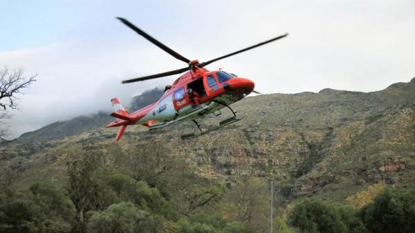
If you feel lost or threatened, rather summon help quickly and at least have someone monitoring you, than leave it too late (even if this is the BnB owner you are staying with). Wilderness Search and Rescue (WSAR) can be reached on 021 937 0300. The What3Words app is a good one to have on your phone in order to communicate your location easily.
There are some really great nature and trails to be explored around Cape Town, but it is essential to be prepared before going out. It is absolutely not to be considered a “walk in the park”.
Make sure your phone battery is fully charged, you have some clean drinking water, a good hat, a jacket, and ideally also have mobile data available. Also check the weather reports before leaving, and remember that in strongish winds the cable car station closes (as I discovered one day and had to descend Table Mountain in the dark).
See https://www.capetownetc.com/news/wsar-rescues-trail-runner-in-jonkershoek-nature-reserve/