
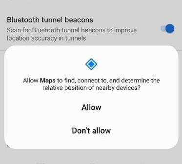
A new feature spotted by SmartDroid allows the Android version of the app to use Bluetooth beacons to track your location in areas where GPS signals typically can’t reach.
These beacons transmit Bluetooth signals that give location data to your phone, according to the Google-owned Waze, which already supports the feature. The app then uses this information along with the device’s mobile connectivity to “provide real-time traffic data as it would with a typical GPS connection.”
The only caveat is that the feature will only work if the tunnel you’re travelling through has Bluetooth beacons installed.
So, this is going to depend on whether these beacons exist in your tunnels and whether there is a partnership in place. But for commuters that regularly travel through long tunnels, this could be pretty useful. It does seem, too, that Waze on iOS already also has this functionality.
I would think though that any static Bluetooth, or even Wi-Fi SSID, could be used to determine locations, if the app knows which of those beacons are located where.
Why would you actually need to know where you are inside a tunnel? I’m not sure, but it sounded like an interesting way of using existing technology to fill some empty gaps.
See https://www.theverge.com/2024/1/16/24039896/google-maps-android-tunnels-bluetooth-beacons