
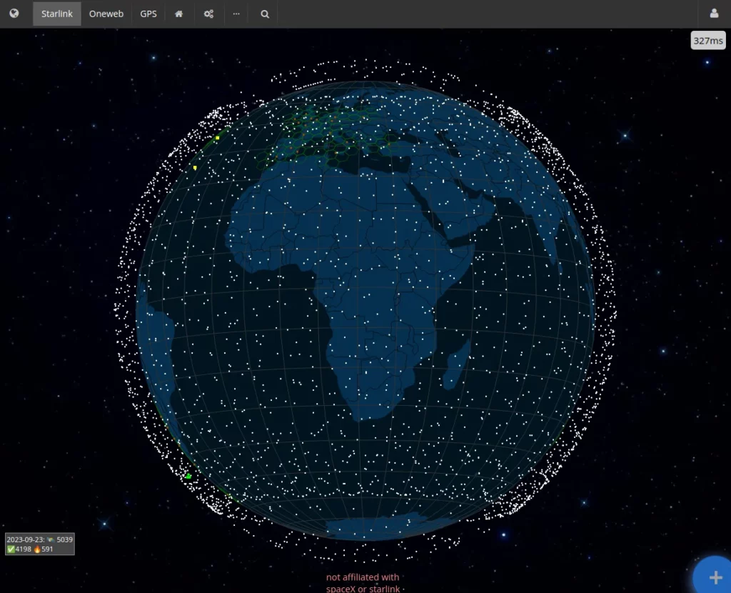
This is quite an interesting animation which really highlights very well how good the Starlink satellite coverage is. Even for continents like Africa there is pretty good coverage, and over the vast oceans as well.
You can change the view to see GPS satellites and then you notice they are a lot higher altitude than Starlink’s satellites. If normal mobile phones could start to use these low orbiting satellites, we’d really be able to connect all humans on Earth, and have coverage during disasters, or treks out into the uninhabited areas.
As long, of course, as you can trust the provider of the satellite service, whether it be an individual billionaire or a spy-happy nation state. This brings a whole new era in being able to data mine what passes through (or even under) this network.
Spotted this piece of news on Mastodon from @[email protected]
See https://satellitemap.space/
#technology #satellitecomms #Starlink